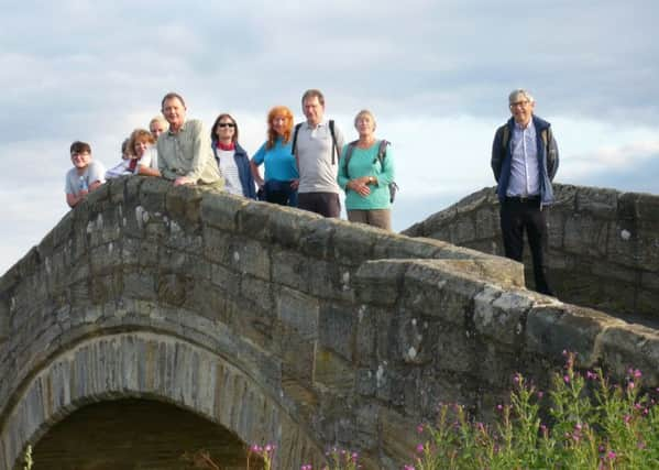
Wonderful views of Northumberland for Morpeth Footpaths Society


On a very hot and humid Saturday, July 14, Morpeth Footpaths Society met at Thrunton Woods to complete the challenging Four Crags Walk.
This walk covers a distance of ten miles and nearly 700m of ascent.
Advertisement
Hide AdAdvertisement
Hide AdWe started off from the main car park and followed the path around the northern edge of the wood, before climbing steeply to the top of Thrunton Crag.
Here, we stopped for lunch.
During the break, we were able to admire the wonderful view across rolling farmland to the Cheviot Hills in the north.
After lunch, and coming out of the trees, we skirted the southern edge of Callaly Crag, and then it was out onto open moorland.
The heather was just beginning to come into flower and there was a distinct purple tinge to the surrounding landscape.
Advertisement
Hide AdAdvertisement
Hide AdWe then started the steep climb the top of Long Crag, the highest point on our route.
This was the ideal place for another stopping point for a snack and to take in the breathtaking views all around us.
We could see the Cheviots and border country to the north and west, the Simonside hills to the south, and the coastal plain and the North Sea to the east.
From there, we walked along the ridge to our final crag, Coe Crag, before descending steeply through the trees to cross the foot bridge over the Coe Burn and back to the car park.
Advertisement
Hide AdAdvertisement
Hide AdThe following Tuesday evening (July 17) we met at Stannington Village Hall, the start of our popular Stannington Circular walk.
Thankfully, the clouds provided some welcome respite from the recent hot weather we have been having.
The route took us over open fields and across several stiles, passing Bellasis Farm, until we reached Bellasis Bridge.
The word ‘Bellasis’, which can be spelled in several different ways, means ‘a handsome place’, and this description is still true of the scenery today in 2018.
Advertisement
Hide AdAdvertisement
Hide AdAfter stopping to admire a lone hare in the field close to the river, we continued to Make Me Rich Farm at Blagdon. This is the home of the Northumberland Cheese Company.
Continuing on our way, we walked along the permissive path to Bog House and onto the estate road towards the New Kennels, passing cottages belonging to the Blagdon Estate along the way.
We then left the peace and quiet of the rural landscape and walked a short distance along the busy and noisy A1 road.
We then headed back to Stannington village. On the journey, we passed the two wooden bus shelters on the old A1, which were designed by Edward Luytens. They were presented to the village in 1937 by Lord Ridley to celebrate the coronation of King George VI.
Advertisement
Hide AdAdvertisement
Hide AdSome members finished the walk with a welcome drink in the Ridley Arms before returning home.
The latest Morpeth Footpaths Society walk took place on Sunday, July .
It was a five-mile circular route, starting and ending at the historic Kirkharle, which was the birthplace of famous landscape gardener and designer Lancelot ‘Capability’ Brown in 1716.
Before the start of the walk we had a look at the monument to Robert Lorraine, who it was said was murdered “barbarously” by the Scots in 1483 as he walked home from church.
Advertisement
Hide AdAdvertisement
Hide AdAfter walking along a tree-lined avenue, we turned left at the main road and headed over fields to higher ground.
We then stopped to have a picnic lunch, enjoying the panoramic view of the surrounding countryside. Shaftoe Crags could be seen in the distance.
The group then returned to Kirkharle via a quiet road and farm tracks.
Afterwards, members enjoyed refreshments in the courtyard of the coffee shop there.
Advertisement
Hide AdAdvertisement
Hide AdSome members of the group also went around the landscaped gardens and serpentine lake, which were designed within the constraints of Brown’s original plans.
There were also a number of interesting shops and workshops to peruse before returning home.
Our next walk takes place on Sunday, August 5.
The society will be meeting for a five-mile (two-and-a-half hour) walk at Great Whittington village. We will then walk along St Oswald’s Way to Matfen.
The terrain is mainly country lanes and paths across farmland, with gentle gradients. However, please note that it can be muddy at times.
Advertisement
Hide AdAdvertisement
Hide AdParticipants should meet at 11am in Great Whittington village, near to the Queen’s Head pub.
Visitors of all ages will be welcome, but sorry, no dogs allowed.
Please call Bill or Wendy, or leave a message on 07746 639559, if you wish to join us.
Directions from Morpeth:
Take the A197 from Morpeth and turn right at Morpeth Golf Club to the B6524 and on through Walton.
Advertisement
Hide AdAdvertisement
Hide AdTurn right at the A696 junction, then take a left to the B6309 to Stamfordham.
After this turn right to Fenwick, onto Matfen and arrive at Great Whittington.
For further information about these walks and our 2018 walking programme, please visit our website at www.morpethfootpathssociety.weebly.com
Alternatively, you can see Morpeth Footpaths Society’s Facebook page, where you can also find details and photographs of members’ recent walks in the area.